Ten Texas water destinations that play a critical role in water supply Posted on July 13, 2021
There’s nothing better than a dip in the water on a hot summer day. Luckily, the Lone Star State is home to a variety of water destinations, from miles of coastal shoreline to springs bubbling out of the desert. Whether you’re rope swinging into a river or taking selfies by the shore, keep in mind that the lakes, rivers, and shoreline are much more than places to cool off and relax. The water destinations we visit recreationally play an important role in our water supply, and each spot is an important part of Texas’s rich history and ecosystem. From Balmorhea Springs in West Texas to Toledo Bend Reservoir between Texas and Louisiana, here are 10 refreshing water destinations across the state and a look at their importance to our water supply, environment, and history.
Central Texas
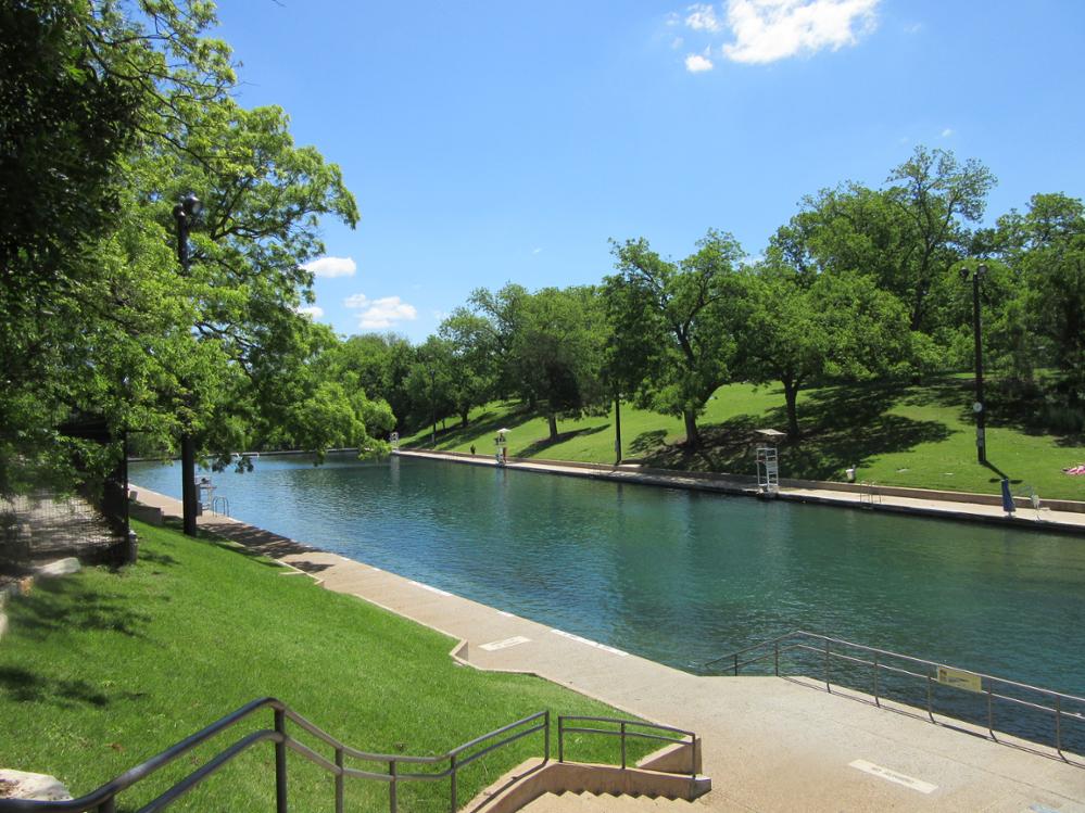
Barton Springs Pool
One of Austin’s most iconic landmarks is also one of the best spots to cool off during a hot summer day. Located in Zilker Park, the three-acre Barton Springs Pool is fed from underground springs, allowing the water temperature to average between 68-70 degrees year-round. The artesian waters in Barton Springs are fed by the Barton Springs Segment of the Edwards Aquifer. Barton Springs consists of four springs: the Main Barton Springs, the Old Mill Springs, Eliza Springs, and the Upper Barton Springs. In addition to supplying the famous swimming hole, the springs provide habitat for several threatened and endangered species and supply downstream water users. The Edwards Aquifer is one of the most productive aquifers in the United States, extending from Kinney County through the San Antonio area and into Bell County. The aquifer is a primary water source for much of Central Texas, including the city of San Antonio.
- Visit: Austin, Texas
- Contact: City of Austin
- Plan your trip: https://austintexas.gov/department/barton-springs-pool
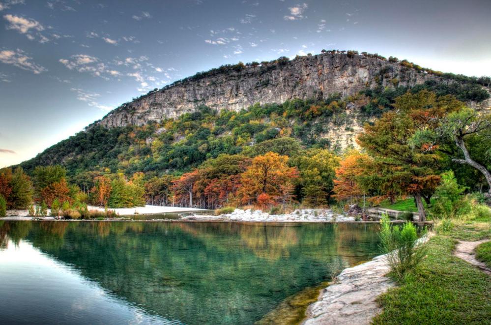
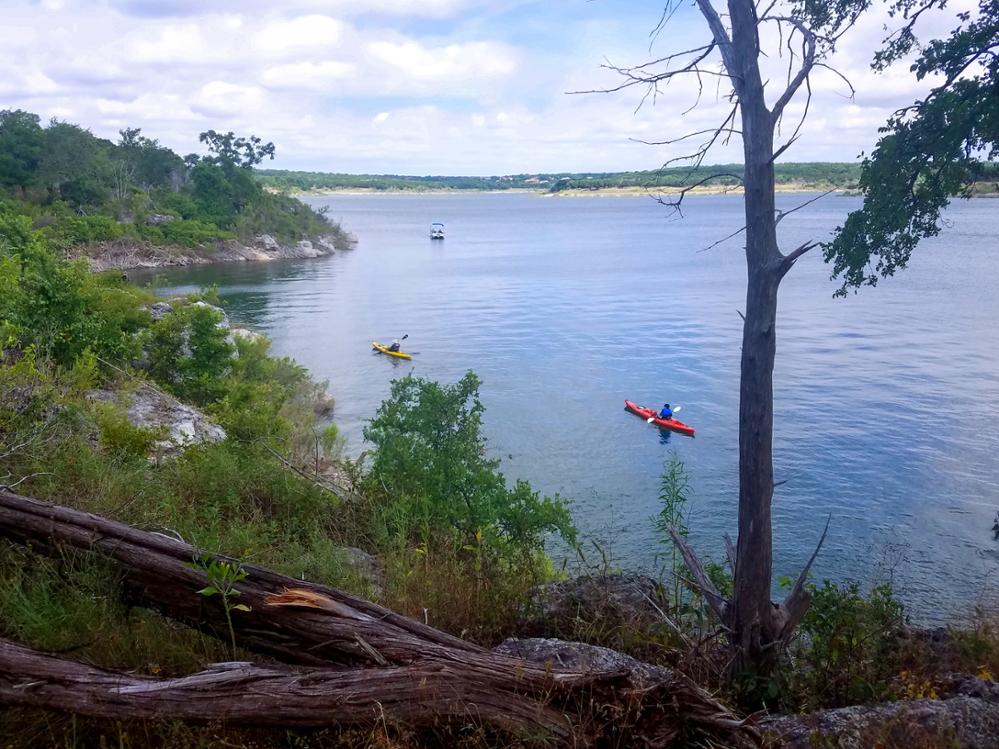
Frio River
Not much beats the fun of floating down a river under the shade of tall trees. Luckily for Texans, there are many rivers in our state to explore and enjoy. Known for its cool and crystal-clear water, the Frio River is one of the top spots for tubing in the Hill Country. The Frio River is surrounded by limestone bluffs and shaded by bald cypress trees for miles. Your options for dipping into the river include public access at roadside crossings, staying at a vacation rental with private access, or visiting one of the Texas Parks and Wildlife Department's crown jewels, Garner State Park. The Frio River is fed by springs and three primary river feeds: the East, West, and Dry Frio rivers. Before emptying into the Nueces River south of the town of Three Rivers, the Frio River provides water to Choke Canyon Reservoir, one of the city of Corpus Christi’s water sources. Ultimately, the water you tube in along the Frio River in the Hill Country could wind up being water out of the faucet in the “Sparkling City by the Sea.”
- Visit: Garner State Park in Concan, Texas
- Contact: Texas Parks and Wildlife Department
- Plan your trip: https://tpwd.texas.gov/state-parks/garner
East Texas
Caddo Lake State Park
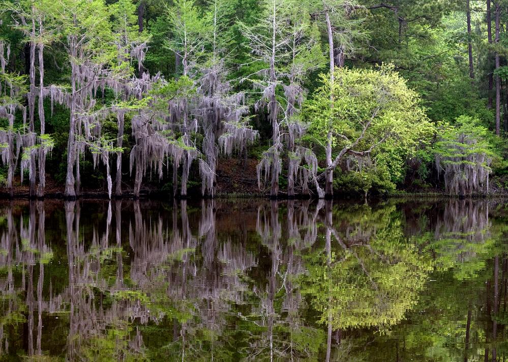
On the Texas-Louisiana state line, guests at Caddo Lake State Park enjoy fishing, canoeing, and kayaking through the bald cypress trees that line the 25,400-acre lake and bayou system. Some alligators also spend time in Caddo Lake, so be sure to follow Texas Parks and Wildlife’s alligator safety tips when visiting. The lake, on the main stem of Cypress Bayou, is named for the Native Americans known as Caddoans or Caddo. Caddo Lake began as one of Texas's few non-oxbow natural lakes and was dammed to improve navigation in the early 1900s. This reservoir is owned and operated by the Northeast Texas Municipal Water District for water supply, water conservation, wildlife protection, and recreational purposes. Caddo Lake, one of 29 sites in the United States recognized as a “Wetland of International Importance,” is at the forefront of efforts in Texas to balance the needs of humans and the environment. Since 2004, The Nature Conservancy, US Army Corps of Engineers, Northeast Texas Municipal Water District, and other local stakeholders have collaborated to sustainably manage water resources in and around Caddo Lake.
- Visit: Caddo Lake State Park in Karnack, Texas
- Contact: Texas Parks and Wildlife Department
- Plan your trip: https://tpwd.texas.gov/state-parks/caddo-lake
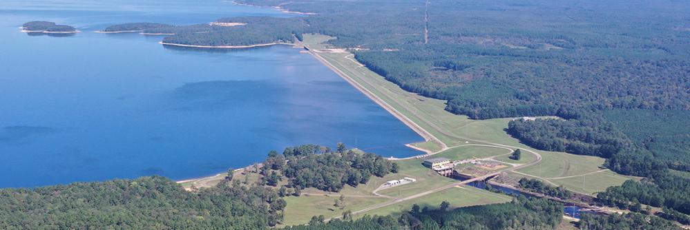
Toledo Bend Reservoir
If fishing, kayaking, or floating in a massive lake sounds like the ticket, head east. The largest reservoir in Texas is formed by Toledo Bend Dam, about 80 miles northeast of Beaumont, on the Sabine River. Toledo Bend Reservoir lies on the border between Texas and Louisiana, and the two states share the water in the reservoir and the electricity produced by two hydroelectric units. With a drainage area of 7,178 square miles and stretching for well over 100 river miles, Toledo Bend Reservoir provides water for municipal, industrial, agricultural, and recreational purposes. Toledo Bend Reservoir is the largest man-made body of water by surface area in the South and the fifth largest in the United States.
- Visit: Burkeville, Texas
- Contact: Sabine River Authority of Texas
- Plan your trip: https://www.sratx.org/basin-development/parks-recreation
North Texas
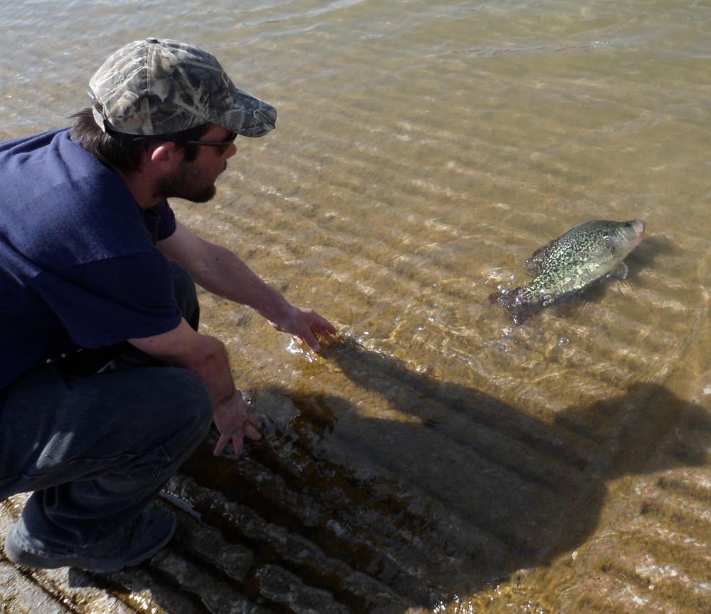
Lake Texoma
If you're in North Texas, you might think you're out of luck when it comes to a weekend getaway on a nearby beach. While it isn’t an ocean shoreline, Lake Texoma features several beaches and swimming areas perfect for building sandcastles or a beach volleyball game. And if lounging on the shore isn’t your idea of fun, try angling for fish. While Lake Texoma is home to many different species, it is known as the “Striper Capital of the World” because it is one of the few reservoirs in the nation where striped bass reproduce naturally. Lake Texoma is formed by Denison Dam on the Red River and lies on the border between Texas and Oklahoma. Denison Dam and Lake Texoma were constructed for flood control, power generation, conservation, and recreational purposes. Owned and funded by the federal government, the US Army Corps of Engineers operates the reservoir.
- Visit: Denison, Texas
- Contact: U.S. Army Corps of Engineers
- Plan your trip: https://www.recreation.gov/camping/gateways/578
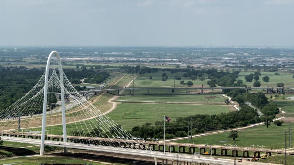
Trinity River
Many Texas canoeing enthusiasts regard the Trinity River between Lake Ray Roberts and Lake Lewisville as an excellent location for riding the water. The Trinity Basin is the largest river basin with a watershed area located entirely within Texas and the third largest river in Texas by average flow volume. The basin's namesake river was called La Santisima Trinidad, "the Most Holy Trinity," by early Spanish explorers. From the confluence of its Elm and West forks near Dallas, the Trinity River flows to Trinity Bay and drains into the Gulf of Mexico. Smaller streams within the basin include the Clear, East, Elm, and West forks of the Trinity River and Cedar, Chambers, and Richland creeks. The Trinity River supplies water for domestic, industrial, and agricultural use in the Dallas-Fort Worth metroplex and additional areas downstream, including the city of Houston, all the way to the bay.
- Visit: Dallas, Texas
- Contact: Texas Parks and Wildlife Department
- Plan your trip: https://tpwd.texas.gov/fishboat/boat/paddlingtrails/inland/dallas_trinity
West Texas/Panhandle
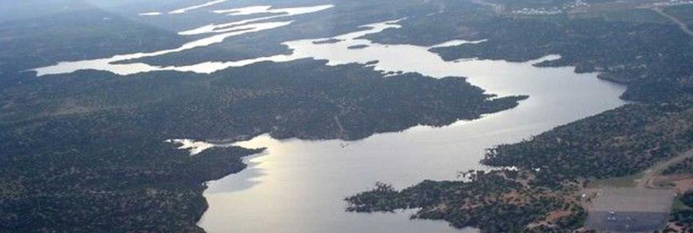
Alan Henry Reservoir
Alan Henry Reservoir (also known as the John T. Montford Dam and Lake Alan Henry) is located about 65 miles southeast of Lubbock. Visitors from the Texas Panhandle and neighboring states, like New Mexico and Oklahoma, enjoy boating, fishing, and camping at the Sam Wahl Recreational Area on the reservoir. If hiking and nature photography are your passions, the Lake Alan Henry Wildlife Mitigation Area is accessible with advanced permission from the city of Lubbock's Parks and Recreation Department. The wildlife area is located north, east, and south of the John T. Montford Dam and includes more than 3,600 acres of wildlife habitat that is managed under state and federal guidelines. The dam impounds water in the South Fork of the Double Mountain Fork of the Brazos River, thereby creating the reservoir. Alan Henry Reservoir is named in honor of former Lubbock Mayor Alan Henry for his efforts to secure an additional water supply for Lubbock's residents. The city of Lubbock owns and operates the reservoir for water supply, irrigation, and recreational purposes.
- Visit: Justiceburg, Texas
- Contact: City of Lubbock
- Plan your trip: https://ci.lubbock.tx.us/departments/lake-alan-henry/home
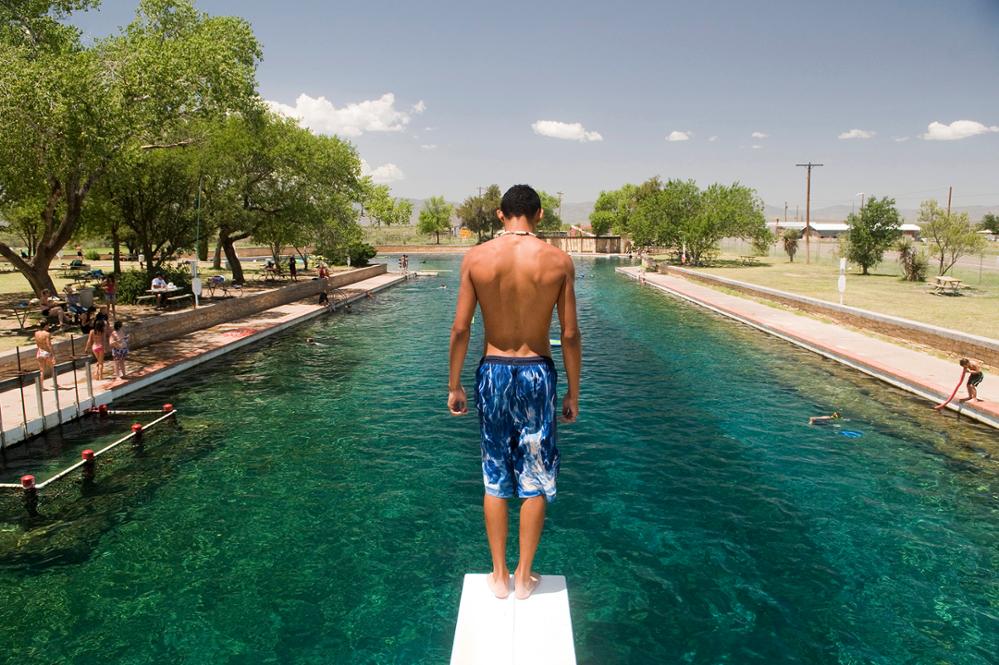
Balmorhea State Park
One of the world’s largest spring-fed pools is in the West Texas desert, about 400 miles from San Antonio and 200 miles from El Paso. The San Solomon Springs (also known as Mescalero Springs and Head Springs) bubble up from the foothills of the Davis Mountains in Reeves County. The springs deliver 20-28 million gallons of water a day to Balmorhea State Park, a swimming hole built by the Civilian Conservation Corps in the 1930s. Visitors to the pool dive into 72-to-76-degree waters year-round, and the pool measures an impressive 1.75 acres in size. The springs that feed the Balmorhea pool historically provided a considerable amount of water for this semi-arid part of Trans-Pecos Texas and continue to provide water for irrigation and recreational purposes. The springs also support two federally endangered fish species.
- Visit: Toyahvale, Texas
- Contact: Texas Parks and Wildlife Department
- Plan your trip: https://tpwd.texas.gov/state-parks/balmorhea
South Texas
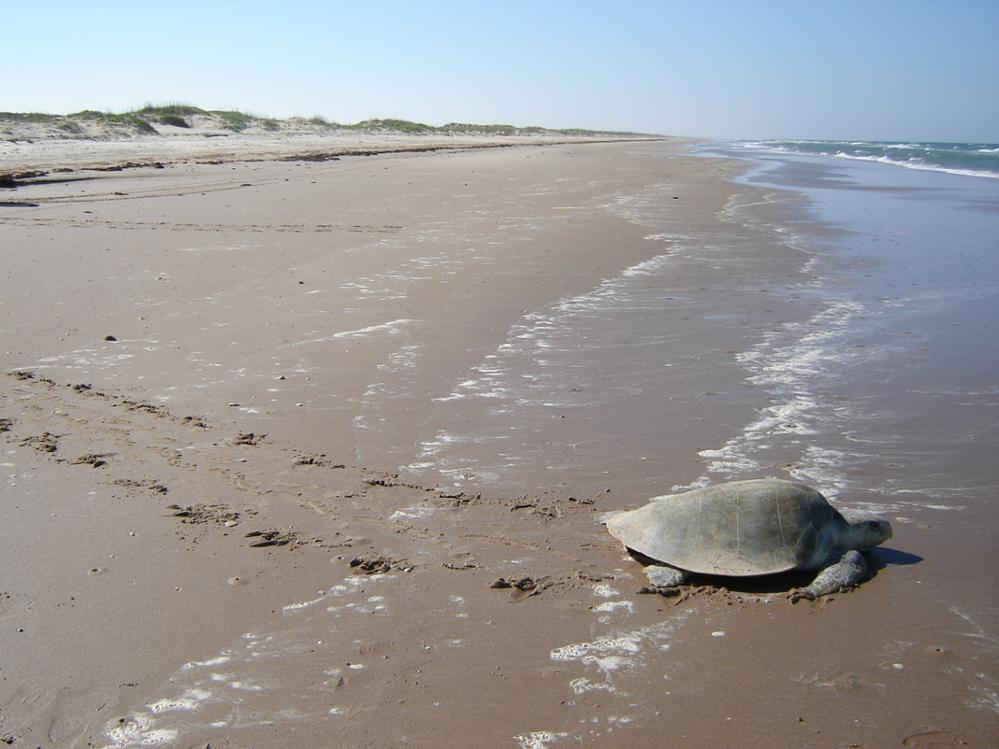
Padre Island National Seashore
While South Padre Island is famous as a vacation destination for beachgoers who want sun, sand, dining spots, and nightlife, the northern portion of Padre Island offers visitors the opportunity to experience the island in a more natural state. Padre Island National Seashore is the longest undeveloped barrier island in the world and the longest seashore in the National Parks System. More than 70 miles of the island's coastline are protected. Extensive dune fields offer scenic beauty and act as a barrier that prevent storm surge from destroying grasslands. Many Padre Island National Seashore visitors come to experience a public release of Kemp's ridley sea turtle hatchlings, the smallest and most critically endangered sea turtle species. In addition to Kemp's ridley sea turtles, coastal wetlands are critical habitat for millions of migrating waterfowl and home to many plants and animals. Limited freshwater ponds on Padre Island National Seashore are an extremely important source of drinking water for coastal wildlife.
- Visit: Malaquite Visitor Center on North Padre Island
- Contact: National Park Service
- Plan your trip: https://www.nps.gov/pais
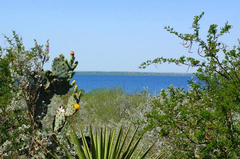
Falcon International Reservoir
Falcon International Reservoir is unique because the lake straddles the border between the United States and Mexico. The 84,000-acre reservoir was formed by the construction of the Falcon Dam and is located 40 miles southeast of Laredo on the Rio Grande. In addition to fishing at one of the best freshwater fishing lakes in Texas, visitors to Falcon Lake can also swim, camp, birdwatch, water ski, boat, geocache, or hike. According to the Texas Parks and Wildlife Department, Falcon Lake and Dam are managed jointly by the United States and Mexico through the International Boundary and Water Commission for water conservation, flood control, hydroelectric energy, and recreation. By treaty, Texas has rights to 58.6 percent of the total conservation capacity. In addition to being a great place to visit, the reservoir is a vital water supply for the farms and communities of the lower Rio Grande Valley.
- Visit: Falcon State Park in Roma, Texas
- Contact: Texas Parks and Wildlife
- Plan your trip: https://tpwd.texas.gov/state-parks/falcon
In Texas, summer offers the opportunity to enjoy and learn more about some of our state’s outdoor water treasures. When you visit these water destinations, please take nothing but photos and don’t leave anything behind. Help do your part to prevent litter and preserve Texas’s waterways and beaches.
To find out more about historical and current reservoir data across Texas, visit the Texas Water Development Board’s Water Data for Texas resource at https://waterdatafortexas.org/reservoirs/statewide.
This article is posted in .