Ask an expert: A coastal flood modeler explains compound flooding Posted on May 11, 2021
What is compound flooding?
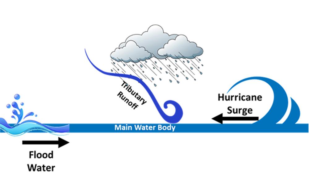
Compound flooding refers to a phenomenon in which two or more flooding sources occur simultaneously or subsequently within a short period of time.
In terms of coastal flooding, a compound flooding event is flooding caused by the interaction of the open ocean, atmosphere, and watersheds. The most common type of coastal compound flooding—a combination of storm surge and riverine flooding—can produce floodwaters that are longer in duration and more widespread than anticipated.
How does coastal compound flooding affect Texans?
The Texas coast is vulnerable to storm surge from tropical cyclones, heavy rainfall, and sea-level rise. While any of these flooding sources can cause flooding, a combination of these sources can lead to higher inundation levels and extents along the Texas coastline. Higher inundation levels not only threaten the lives and property of nearly 6.5 million people and numerous industries located in the coastal zone but can also cause pollution.
Why is it important to understand compound flooding?
In recent decades—and as we experienced with Hurricane Harvey— increasingly destructive coastal storms can be attributed to higher levels of flooding caused by the combined effects of precipitation runoff and storm surge. The interaction among processes involved in a compound flooding event is very complex. We can’t simply quantify these effects by adding them up, because the interaction is highly non-linear and requires using advanced physical and mathematical models. A clearer understanding of compound flooding is necessary to provide more accurate flood risk estimates. Additionally, flood preparedness and mitigation plans based on modeling that includes the effects of compound flooding could significantly reduce the cost of disaster response and recovery.
How is Hurricane Harvey an example of compound flooding?
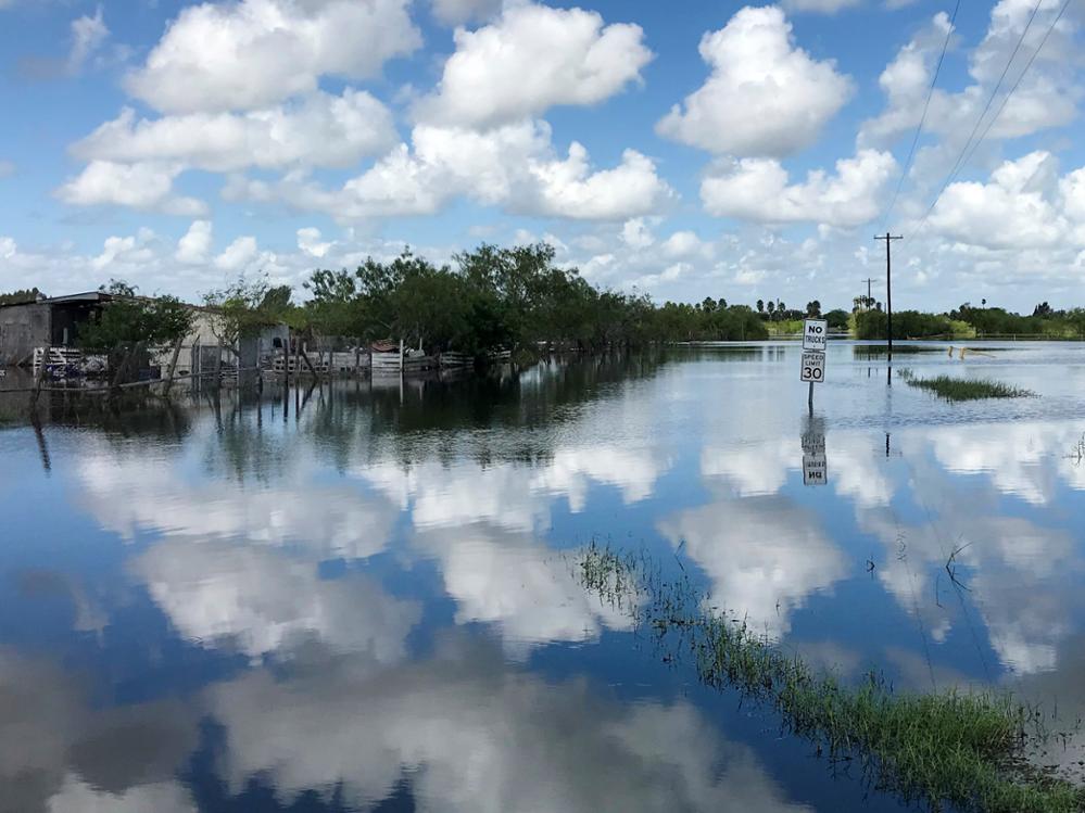
Hurricane Harvey caused a 6-foot storm surge in Corpus Christi and brought more than 50 inches of rainfall to the Houston and Beaumont areas. The Houston and Beaumont areas had 2- to 3-foot storm surges that caused some initial inundation but also blocked the drainage of runoff generated by the rainfall. Additionally, Hurricane Harvey caused numerous watersheds, from Rockport, Texas, to southwest Louisiana, to flood at the same time. The high volume of discharge from all of these watersheds and their discharge angles that, in some cases were toward the outlet point of another watershed, caused backflow, which amplified the inundation.
How will rising sea levels affect compound flooding?
Recent studies demonstrate that future sea-level rise could increase the frequency of compound flooding events and intensify the compounding effects of individual flood drivers. In other words, sea-level rise coupled with the observed long-term climate trends could lead to more frequent and powerful compound floods.
Why is it challenging to simulate compound flooding?
During a compound flooding event, the interactions among processes like tides, storm surge, sea-level rise, wind, and river discharge are very complex. Traditional models have been used to simulate one or more of the processes involved in compound flooding, but not all of them together.
Are there efforts to update the methods typically used to evaluate coastal risks to produce more accurate flood hazard assessments?
As of now, there is no holistic method to assess flood risks caused by compound flooding events. There are many ongoing efforts in academia, state and federal agencies, and private companies to tackle such a challenging problem. Not only do we need better physical models (or data-driven ones) and coupling techniques, but we also need improvement in our statistical approaches to estimate the risk.
Currently, the Texas Water Development Board is coordinating the Texas Integrated Flooding Framework project in partnership with the U.S. Geological Survey and the U.S. Army Corps of Engineers – Galveston District. This comprehensive flood risk planning project will create an integrated framework to provide local, regional, and state entities with the compound flood risk information and planning tools necessary for comprehensive regional flood planning and mitigation in the coastal zone. The Texas General Land Office, through its Community Development Block Grant Disaster Recovery Program, is funding the project, which is expected to be completed in summer 2024.
About Dr. Amin Kiaghadi
As a Coastal Flood Modeler at the Texas Water Development Board, Dr. Amin Kiaghadi performs advanced modeling and engineering work to support regional and state flood planning in Texas. This includes developing, maintaining, and applying hydrologic, hydraulic, and hydrodynamic models across river, estuary, and open ocean scales. He is also the Texas Integrated Flooding Framework project manager. In this role, he shares information about coastal flood modeling at public meetings; provides technical support to stakeholders and customers; and develops working relationships with state and federal agencies, academic institutions, and private contractors to advance the use of coastal modeling.
This article is posted in Flood .